TycheHowTo:GeocodeData
The act of geocoding involves taking row-level attribution - typically an address but it could include a postcode (ZIP+4, ZIPCode, FSALDU) or a property parcel identifier - and using that information to identify a location associated with the attribution. Attaching a location - (X, Y) or (Longitude, Latitude) - to a row of data could help you perform a number of spatial-oriented operations. You can place your data on a map, you can use locations to enrich a record by doing spatial lookups, and you can group or organize records of information based on its location.
The purpose of this document is to suggest a number of strategies and resources that you could use to geocode any data files that you want to analyze, where the act of geocoding is imperative to perform some aspect of your analysis.
Use existing Longitude Latitude data
Many datasets come with longitude and latitude columns or fields already in the data. Look for fields that say (Lon, Lat), (X, Y), (Longitude, Latitude) or other variants, e.g. "LON_X".
Most coordinate information will be in a cartesian coordinate system that is bounded between -180 to +180 (East to West) and -90 to +90 (North to South). Some geocoded coordinates make use of other coordinate systems.
If there is coordinate data within the public data you can questions such as "how was the data geocoded or where do the coordinates come from?", "what is the accuracy of the geocoding?" and "what EPSG is the data in?"
US Census Geocoder
If you are geocoding solely in the USA you can make use of the US Census Bureau's geocoder. This geocoder makes use of the Census TIGER data files to find the best match and location. To use the geocoder you will import a csv file with a specific file format identified in the documentation.
Geocode to Parcel Centroids
If you are geocoding data that is associated with a parcel (for example a zoning database, a building permit database, a property sales database) and you have a parcel identifier or APN, you may be able to geocode using a parcel centroid database. As you examine the county or state's parcel data you may find either a parcel centroid database or a parcel boundary database, and either may already have latitude and longitude fields for each parcel.
In the example below envision that you have a zoning code database where each record has a property ID or APN. If you have imported parcel data that contains X, Y location data you could build an XLOOKUP from the former to the latter to enrich your zoning code database with the actual location.

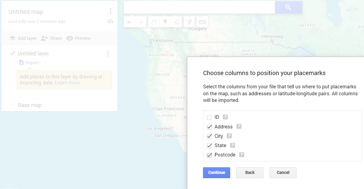
Geocode with Google My Maps
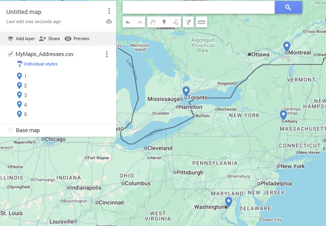
Google My Maps make it easy to create a map with point location data that has not been geocoded yet.

Google My Maps will then geocode all records in the file to the best of its ability.

The biggest disadvantage of My Maps is that you are unable to see or download the location coordinates that have been associated with each record in your table or database. My Maps may also have some issues with secondary unit information (apartments, units, floors) so we recommend not referencing secondary unit information when geocoding with My Maps.
Geocode using Local Public geocoders
In some states, provinces and countries a local geospatial team has taken the best data available and created a local geocoder. Typically these are implemented as ArcGIS (Esri) geocoding services. If you are using ArcGIS or other Esri technology the process to use these geocoding services is relatively straightforward. If you do not have access to ArcGIS technology you can utilize QGIS to connect to these services.
Examples of these geocoding services are below for a number of states and provinces. At the bottom of this seciton is a document that explains how to connect to the geocoding services from QGIS.
British Columbia
https://www2.gov.bc.ca/gov/content/data/geographic-data-services/location-services/geocoder
Kansas
https://hub.kansasgis.org/content/cbb74dd89766413e88792e1c8fbb79cd/about
New York
https://gis.ny.gov/address-geocoder
North Carolina
https://arc-gis-hub-home-arcgishub.hub.arcgis.com/content/247dfe30ec42476a96926ad9e35f725f/about
Oregon
https://geohub.oregon.gov/content/d52415395ceb4b0faea09b59cec5277f/about
Accessing Esri Geocoding Services from QGIS
https://plugins.qgis.org/plugins/mmqgis/
Free, low volume commercial geocoders
There are several commercial geocoders that offer low volume geocoding for free. Tyche does not recommend or endorse any of these geocoders, we are just stating their availability. These include: