File:13th Woodlawn TVPA.png
Jump to navigation
Jump to search
Size of this preview: 800 × 579 pixels. Other resolution: 1,051 × 761 pixels.
Original file (1,051 × 761 pixels, file size: 220 KB, MIME type: image/png)
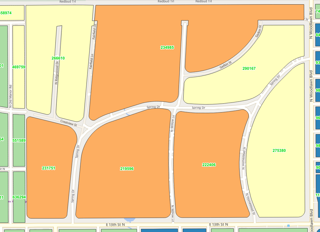
Wichita KS around 13th and Woodlawn, showing blocks and Total Value Per Acre
File history
Click on a date/time to view the file as it appeared at that time.
| Date/Time | Thumbnail | Dimensions | User | Comment | |
|---|---|---|---|---|---|
| current | 19:35, 1 December 2025 | | 1,051 × 761 (220 KB) | WichitaDataExplorer (talk | contribs) |
You cannot overwrite this file.
File usage
The following page uses this file: